Asset Tracking
Realtime visibility into all your assets, wherever they are
Full control over your assets with Flowter
Knowing where assets are and how they are being used is the foundation of an efficient operation. With Flowter, the platform of GPS-Buddy, the location and utilization of all your assets is visible in real time. From heavy machinery to small tools, with or without their own power supply. Prevent unnecessary searching, downtime, and loss. Manage based on actual utilization. All from one platform.
What asset tracking delivers
What are the benefits of asset tracking in Flowter?
Always know where your assets are, on one platform
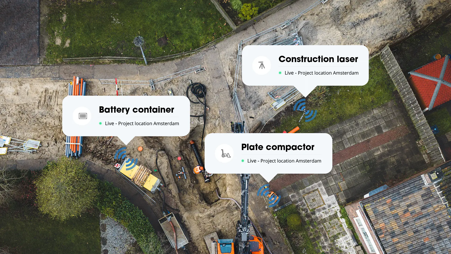
From vehicles and machines to containers and small tools: everything visible on one map in Flowter. See exactly where assets are located, which project they are assigned to, and what is still expected on site.
Less loss and theft
Flowter always shows where an asset is located. Set up alerts for when an asset leaves a designated zone or is used outside planned hours, and know immediately when that happens. Act quickly in case of loss or theft.
Lower costs through insight
Manage based on actual utilization using location and presence data. Which assets have been idle for weeks? What is in the wrong location? Insight into your equipment prevents unnecessary rental, duplicate purchases, and hidden operational costs due to downtime or unplanned transport.
2,000+ industry leaders trust our technology




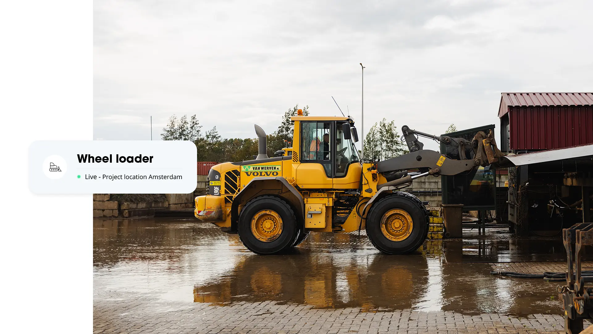
For assets with and without power supply
Knowing where assets are and how they are being used enables better planning. Which equipment is available, what is already on a project, and what can be reassigned? That information prevents unnecessary rental, duplicate purchases, and inefficient utilization. Equipment that ends up in the wrong location has a direct impact on planning and margins. A crew standing idle because a machine is missing, unplanned transport to retrieve assets: these are costs that rarely show up as a single line item, but add up nonetheless. Real-time insight into the location and utilization of every asset provides the foundation to get ahead of these situations.
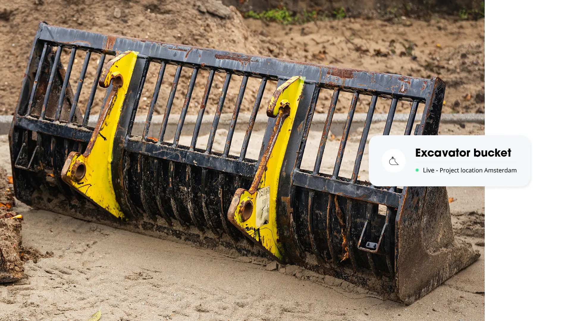
Efficient utilization, fewer hidden costs
Knowing where assets are and how they are being used enables better planning. Which equipment is available, what is already on a project, and what can be reassigned? That information prevents unnecessary rental, duplicate purchases, and inefficient utilization. Equipment that ends up in the wrong location has a direct impact on planning and margins. A crew standing idle because a machine is missing, unplanned transport to retrieve assets: these are costs that rarely show up as a single line item, but add up nonetheless. Real-time insight into the location and utilization of every asset provides the foundation to get ahead of these situations.
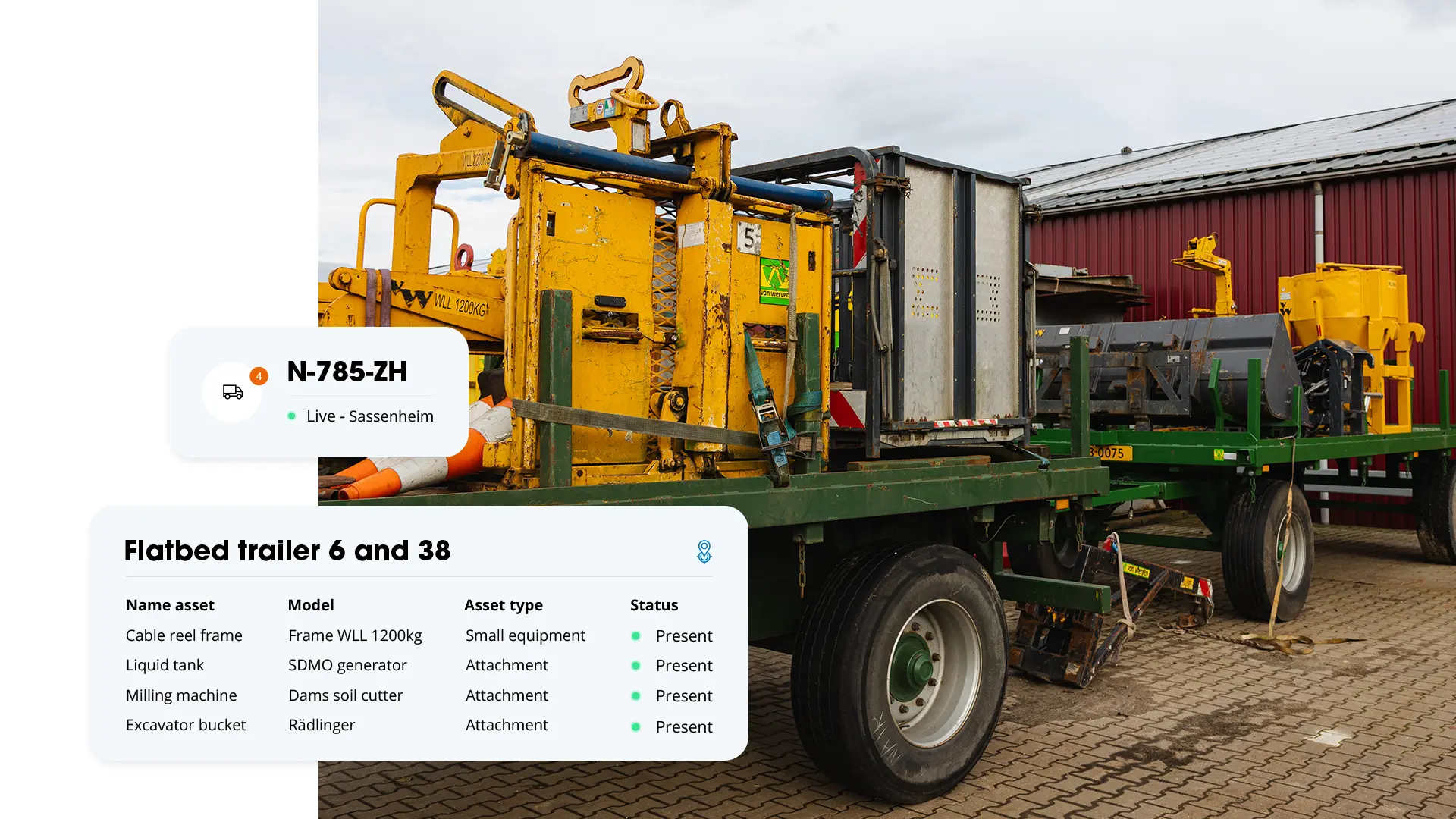
Cargo Recognition
Knowing where equipment is located is already possible with asset tracking. The vehicle tracking system shows where vehicles are driving. Cargo Recognition combines the two: it shows which vehicle equipment is travelling with. As soon as a GPS-Buddy RFID tag is on a piece of equipment, the XT-4 gateway automatically recognises whether it's in the vehicle, on the trailer or on the low-loader. The driver doesn't have to scan or report anything.
These solutions may also interest you


Protection against theft
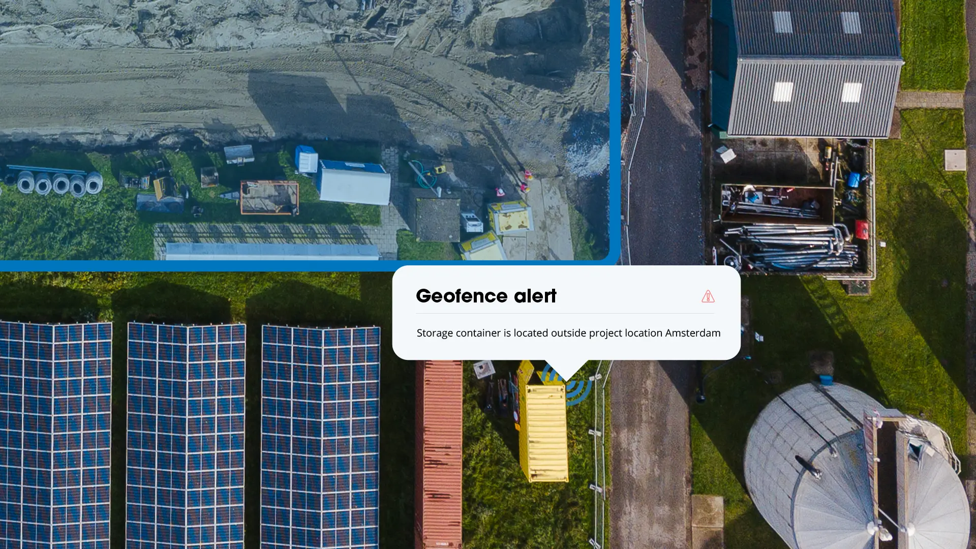
In Flowter, geofences can be set up around project sites, depots, and work sites. These are digital boundaries that correspond to the actual location of a project or terrain. This way, it is always clear which assets are present at each location. If an asset leaves a designated zone, or a vehicle or machine is used outside planned hours, an alert can be configured so immediate action is possible. Unauthorized use or theft becomes visible quickly, without the need for constant manual monitoring.
Real-time monitoring through smart RFID technology
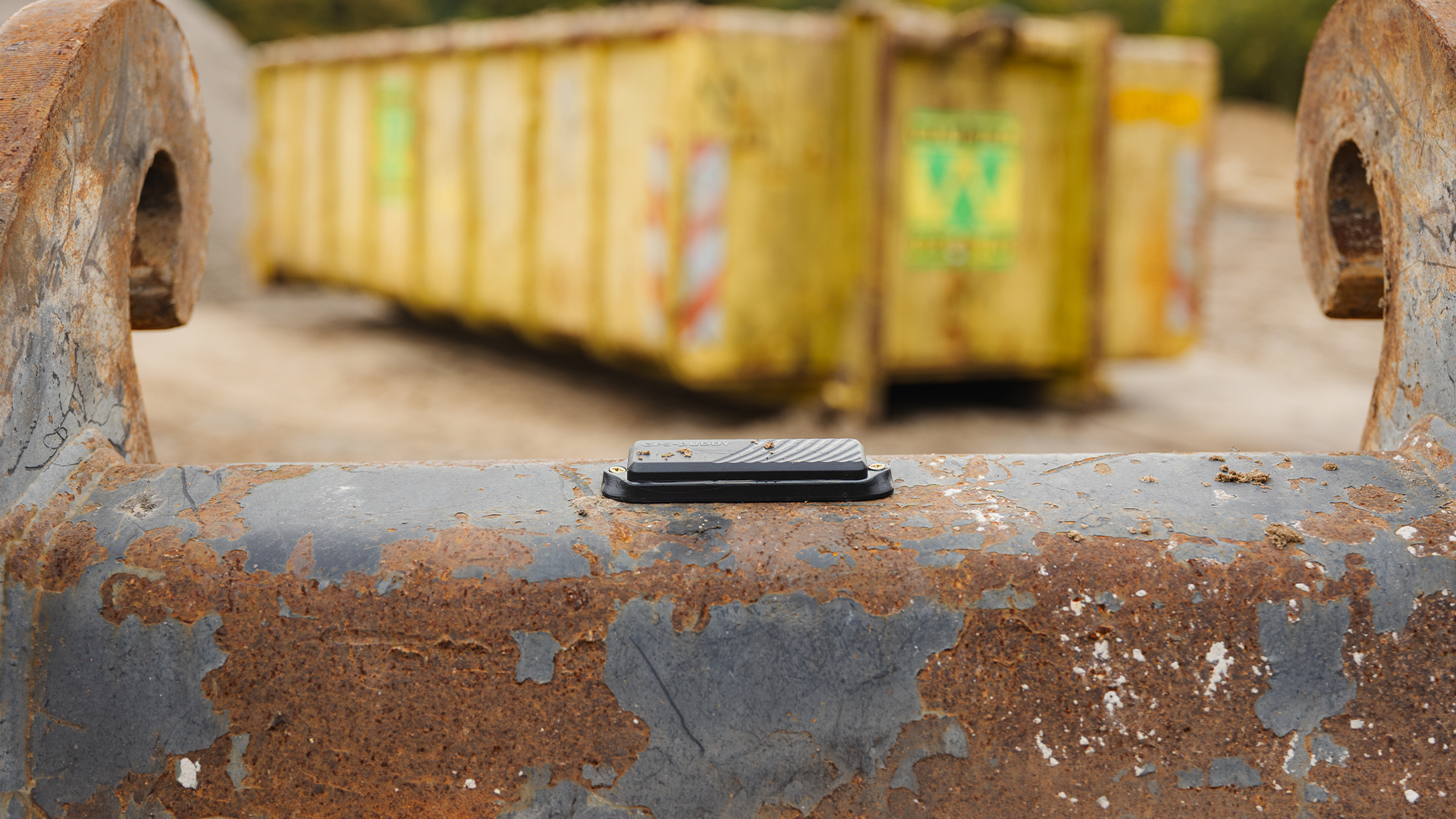
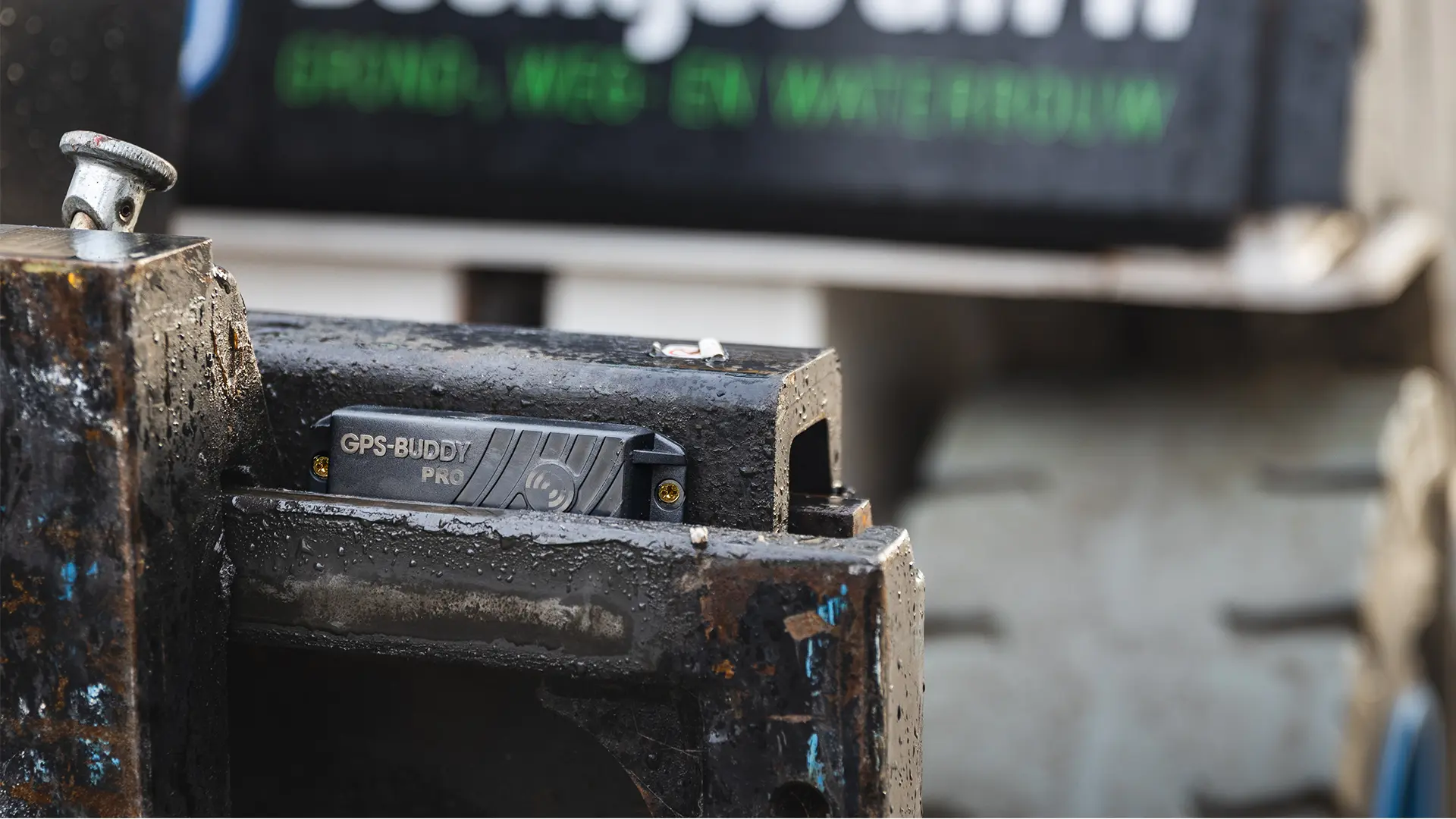
GPS-Buddy operates a network of RFID tags and XT4 gateways. The XT4, our hardware built into vehicles and machines, continuously sends location and usage data to Flowter. RFID tags are attached to assets without their own power supply and automatically transmit a signal. As soon as a tag comes within range of an XT4 gateway, the location is immediately visible in Flowter. RFID offers a wide range and is suited for a variety of work environments, from open terrain to busy project sites. With a battery life of up to eight years, the tag operates for years without maintenance.
All data comes together in Flowter, the GPS-Buddy platform: vehicles, machines, equipment, and people visible in real time in one platform. A complete picture of the operation, at the moment it matters.
What our customers say
"We handle many international moves, for both private individuals and organizations such as museums. For our clients, it is essential to know where their belongings are and when they will be delivered. Moving is also one of the most significant events in most people's lives, and it comes with a lot of emotion. With GPS-Buddy, we make sure these people experience as little stress as possible by giving them temporary real-time visibility through the online platform."
Peter van Setten
Owner @ Peter van Setten
"With GPS-Buddy, we now have a system that truly fits our reality. These RFID tags have a battery life of no less than eight years, even if they were to transmit a location every minute. No complicated installations, no maintenance concerns. These RFID tags are brilliant — no power needed, and incredibly easy to attach. Just a reliable system that does what it needs to do."

Willem Post
Maritime Manager @ City Barging
"When we rent out certain machines to a job site and it is indicated that a machine will not be used on a specific day, we put that machine in park mode on that day. By running an I/O report in GPS-Buddy, we can see whether the machine was used or not."

Marco Tieleman
Branch Manager @ Dura Vermeer
From asset tracking to asset intelligence
Asset tracking is one part of a bigger picture. GPS-Buddy does not just track assets — it also shows how they perform. This gives you a complete view of the entire operation: machines, people, equipment, and vehicles. The insights this delivers is what we call asset intelligence. Flowter translates asset data into insights that organizations can act on directly.
Read more about GPS-Buddy for asset tracking
Frequently asked questions and answers. Is your question not listed? Then contact us.
What is asset tracking?
Asset tracking is the monitoring and recording of physical objects, also referred to as assets, such as machines, vehicles, containers, and tools. Using technologies such as GPS and RFID, it is possible to see where assets are located, how they are being used, and whether they are available. This gives organizations the foundation to plan more efficiently, prevent loss, and reduce costs.
What is the difference between asset tracking and fleet management?
Fleet management focuses specifically on vehicles: trip registration, driving behavior, fuel consumption, and maintenance. Asset tracking is broader and covers all physical assets within an organization, including those without a power supply — such as machines, containers, scaffolding, and small tools. The two solutions complement each other: fleet management provides insight into how vehicles are used, while asset tracking covers where all other assets are located and how they are deployed.
Is asset tracking suitable for companies with equipment that has no fixed power supply?
Absolutely. GPS-Buddy works with standalone trackers and tags that are ideal for tools, containers, and machines without their own power source.
What is RFID?
RFID stands for Radio Frequency Identification. It is a technology that enables wireless, remote data exchange between a small chip — the tag — and a scanner. It works via radio waves and is widely used for identification, security, and object tracking.
GPS-Buddy uses RFID to make assets visible in Flowter. A tag is attached to the asset and automatically transmits a signal that is picked up by an XT4 gateway, built into vehicles and machines in the area. RFID tags have a wide range, last for years, and do not require a power connection on the asset itself.
Can I link my assets to projects or locations?
Yes, every object can be linked to a project, job, or cost center. Perfect for reporting, invoicing, and internal allocation.
What types of equipment can I track with GPS-Buddy?
From excavators, loaders, and containers to saw tables, compactors, and measuring devices – everything is visible, even without its own power supply.
What is the advantage of RFID compared to GPS?
RFID offers a greater range than Bluetooth and makes passive equipment visible. Objects without their own power supply can still be tracked, as tags automatically communicate with a gateway in the vicinity. RFID tags require no power connection, are built to withstand harsh conditions, and operate for years without maintenance.
Can I view my assets through an app?
Yes, Flowter is available as an app. This means assets are always accessible, whether on the road or on site.
What is the difference between the RFID Asset Tag and the AT4 GPS Tracker?
The RFID Asset Tag has no GPS of its own and works through the network of XT4 gateways. It is suitable for most assets without a power supply and lasts up to eight years on a single battery. The AT4 GPS Tracker has its own GPS and its own connection, making it suitable for assets that fall outside the gateway network.
What are hidden operational costs and how do you prevent them?
Hidden operational costs arise when things do not go as planned. A job that is not completed on time, equipment that is unavailable, or work that needs to be redone. These are costs that rarely appear as a single line item, but they do put pressure on margins. In construction and infrastructure, this translates to concrete situations: a crew standing idle because equipment is not in the right location, unplanned transport to retrieve assets, or duplicate rentals because equipment cannot be found. Real-time insight into the location and utilization of assets provides the foundation to prevent these situations. With Flowter, it is always clear where equipment is located, enabling better planning and preventing downtime before it becomes costly.
What is geofencing?
Geofencing is a technology that allows a virtual boundary to be set around a specific physical location. In Flowter, geofences can be configured around project sites, depots, and work sites. This makes it always clear which assets are present at each location. Alerts can also be set up for when assets leave a zone or are used outside planned hours.