

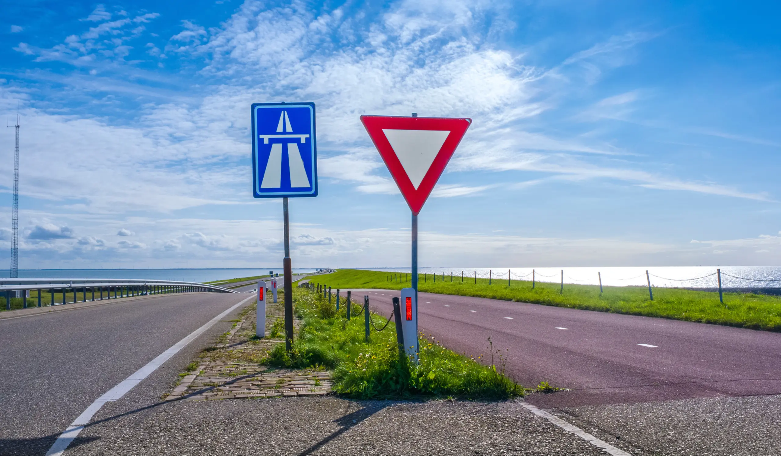
ITS-Regeling: everything about the obligation to share traffic information digitally
Since 21 December 2025, public authorities must make traffic information available as digital data, so that navigation systems and vehicles can use it directly. This is set out in the revised ITS-Regeling. Up to and including 2028, this obligation will be extended step by step to more types of information and more roads.
This article explains what the ITS-Regeling involves, what already existed, which data falls under it, what changes when and which organisations are involved. It also covers how traffic information ends up in the navigation, why that does not always go well and what this means for roadworks.

29 October 2026
Een content subheading
15 min read
What is the ITS-Regeling?
The ITS-Regeling is the Dutch implementation of the European ITS Directive. ITS stands for Intelligent Transport Systems: systems that use traffic information to inform travellers and make traffic safer and smoother. Examples include navigation, route planners and speed assistance in the car.
The basis is Directive 2010/40/EU. On 22 November 2023 it was revised by Directive (EU) 2023/2661. Member states had to transpose the revision into national law by 21 December 2025 at the latest. The Netherlands did so with an amendment to the ITS-Regeling, published in the Staatscourant (Government Gazette) on 18 November 2025 and in force since 21 December 2025.
What is new?
Until 21 December 2025, parties only had to share traffic information if it was already available in digital, machine-readable form. If a speed limit appeared only in a PDF of a traffic order, it did not have to be supplied as data.
That has changed. Parties must now convert traffic information into a digital, machine-readable format themselves, even if it only exists in a document. Machine-readable means: directly readable and processable by IT systems and apps, without an extra conversion step. The data largely comes together at the Nationaal Dataportaal Wegverkeer (NDW), which makes it available to navigation services, among others.
This happens in stages. First, the obligation applies only to traffic rules that are new or change. Later, existing rules must also be digital, such as speed limits that have applied for years. Which stage applies when is explained further on in this article.
The regulation does not require parties to collect information that does not yet exist. It concerns information that a road authority already holds as part of its task, such as a traffic order that has been issued.
What is the difference between ITS and RTTI?
Two abbreviations appear in reports on this topic: ITS and RTTI. The ITS Directive is the framework. It determines that traffic information must be available digitally and which data this concerns from when. A directive must be transposed by each country into its own legislation; in the Netherlands that is the ITS-Regeling.
RTTI stands for Real-Time Traffic Information. It is a delegated European regulation under the ITS Directive: Regulation (EU) 2022/670, for EU-wide real-time traffic information. A regulation applies directly in all member states. RTTI sets out which traffic information is concerned and how it is to be supplied. Speeds, closures and roadworks fall under it.
Besides RTTI, there are three more regulations under the ITS Directive: for road safety information (SRTI), for truck parking areas (SSTP) and for multimodal travel (MMTIS).
Who has to do what?
The regulation places obligations on two groups:
- Parties responsible for the data. For traffic rules and roadworks these are the road authorities: Rijkswaterstaat, provinces, municipalities and water boards. For other data it concerns, for example, operators of truck parking areas or public transport parties.
- Service providers. From 31 December 2026, navigation and route planning services, in-car systems and public information channels must pass on road safety information to their users free of charge, on the main European routes. Examples include a warning about a wrong-way driver or an obstacle on the road.
What already existed?
The ITS-Regeling does not start from scratch. The Netherlands has been sharing traffic information digitally for years, but not yet completely and not everywhere in the same way.
- National Access Point. The first ITS-Regeling took effect on 1 July 2015. In the same year NDW launched the Nationaal Toegangspunt ITS, initially with data on truck parking areas and road safety on national roads. The RDW became the supervisory authority.
- Traffic orders. Road authorities publish their traffic orders on officielebekendmakingen.nl: municipalities in the Gemeenteblad, provinces in the Provinciaal Blad and central government in the Staatscourant. Since 1 July 2021, each government body publishes in its own gazette; before that, traffic orders appeared in the Staatscourant. A traffic order is a legal text document, often with a map or drawing as an appendix. People can read it, but navigation systems cannot directly extract which rule applies where.
- Traffic sign database. Between 2020 and early 2023, a large part of the Dutch traffic signs was captured with scan cars and made available as open data, including the sign type and location. This concerns around 1.9 million of the more than 3 million signs in the Netherlands.
- George. Since 2023, road authorities maintain their signs and road characteristics, such as maximum speeds, themselves in the NDW system George. Anyone adding a sign there must enter coordinates. In addition, various road authorities have their own management system for their traffic signs.
- MELVIN. Planned road closures, works and events are reported in MELVIN, the NDW system for reports of disruptions to infrastructure in the Netherlands (Meldingen van Verstoringen in de Infrastructuur in Nederland). Both road authorities and contractors enter reports.
According to the explanatory note to the ITS-Regeling, most data types are already available digitally. The work lies mainly with road authorities: their decisions and reports do not always exist yet in the right digital format. This requires adapted work processes and systems.
Which data falls under the ITS-Regeling?
The obligation applies to 27 data types, divided into five groups.
Traffic rules. The largest group consists of eleven types of traffic rules. These include speed restrictions, one-way roads, overtaking bans for trucks and restrictions on weight, length, width and height. Access to tunnels and bridges, permanent access restrictions and zones such as low-emission zones also fall under it. In addition, there are rules for the delivery of goods, the direction of travel on reversible lanes and traffic circulation plans. In European legislation this group falls under RTTI.
Network status. This group concerns temporary changes on the road. It covers four data types: road closures, lane closures, roadworks and temporary traffic management measures. This group also falls under RTTI.
Road safety. Eight data types concern situations for which road users must be warned immediately. Examples are a wrong-way driver, a temporarily slippery road surface, animals, people, obstacles or debris on the road, an unsecured accident site or an unattended road blockage. Short-term roadworks, reduced visibility and exceptional weather conditions are also included. This group is called SRTI.
Truck parking. Three data types concern parking areas for trucks: where they are located, which facilities and security they offer and how many spaces are free. This group is called SSTP.
Multimodal travel. The last data type concerns stops and stations: where they are located, how accessible they are and which walking routes exist at interchange points. This group is called MMTIS.
For road authorities, the first three groups are the most relevant.
Does it also concern traffic signs?
Not directly. Traffic signs are not a data type. What matters is the traffic rule that a sign indicates, and where that rule applies. The Nationaal Toegangspunt Mobiliteitsdata (National Access Point for Mobility Data, NTM) states in its guidance that the ITS Directive does not create an obligation to digitise traffic signs.
In practice, the two are closely linked. Speed limits and other road characteristics are often derived from the traffic signs in the national database. The location of a sign determines for which part of the road and which direction of travel a rule applies. That makes a correct and up-to-date sign location important, even though it is not a separate requirement in the law.
What has to happen when?
The obligation is being introduced in stages, according to the deadlines in Annex III of Directive (EU) 2023/2661. Two types of deadlines apply per data type:
- New or changed data. From the first deadline, everything that is new or changes must be shared digitally.
- All data. From the second deadline, existing data must also be digital, such as all speed limits that have applied for years.
For temporary situations, such as closures, roadworks and safety reports, only the first type applies. Old reports do not have to be supplied retroactively.
21 December 2025. The revised ITS-Regeling takes effect. From that moment, the obligation to share traffic information digitally applies throughout the Netherlands, in the stages below.
31 December 2025. The first stage applies to the TEN-T core network: the most important European main routes. New or changed traffic rules must be shared digitally there. This concerns speed restrictions, overtaking bans for trucks, restrictions on weight, length, width and height, and access to tunnels and bridges. The same applies to road and lane closures and to roadworks. In large cities, new or changed one-way streets must be shared digitally. Safety reports, such as a wrong-way driver or an obstacle on the road, must be shared on the TEN-T core network, the TEN-T comprehensive network and the other motorways.
31 December 2026. A year later, the same obligation applies to many more roads: the TEN-T comprehensive network, the other motorways, busy main roads and all streets in large cities. New types of rules are also added: rules for the delivery of goods, permanent access restrictions, zones such as low-emission zones and the direction of travel on reversible lanes. Closures and roadworks must then also be shared digitally on the TEN-T comprehensive network. For safety reports, poor visibility and extreme weather are added. From this date, navigation services must also pass on safety warnings on those roads to their users free of charge.
31 December 2027. Until now, the focus was on rules that are new or change. From the end of 2027, all existing traffic rules on the TEN-T core network must also be digital, such as speed limits that have applied for years. The same applies to all one-way streets in large cities.
31 December 2028. A year later, the existing traffic rules on the wider network must also be digital: the TEN-T comprehensive network, the other motorways, busy main roads and large cities. In addition, traffic circulation plans are added, both on the TEN-T core network and on the wider network. Temporary traffic management measures must also be shared digitally on the TEN-T core and comprehensive networks, such as a temporary speed restriction around a work zone.
For a few data types, no date has yet been set by which existing data must also be digital. This applies, among others, to low-emission zones, access restrictions and rules for the delivery of goods. The European Commission will set that date later.
Which organisations are involved?
There is no central body that arranges everything. Traffic information originates at each road authority separately and travels through several organisations to the road user. Each party has its own role.
European Union
The European Parliament and the Council adopt the ITS Directive. The European Commission draws up the four underlying regulations, including RTTI.
Ministry of Infrastructure and Water Management
The ministry transposes the directive into the ITS-Regeling. It is formally the national access point.
Road authorities
Road authorities are Rijkswaterstaat, provinces, municipalities and water boards. They issue traffic orders and supply the data.
Nationaal Dataportaal Wegverkeer (NDW)
NDW collects the traffic data and makes it available, among others to navigation services. It manages MELVIN, George, the traffic sign database and the ITS scope viewer. The latter is the digital map showing on which roads the obligations apply.
NDW is a partnership of 19 authorities: Rijkswaterstaat, the twelve provinces, Amsterdam, Rotterdam, The Hague, Utrecht, Vervoerregio Amsterdam and Metropoolregio Rotterdam Den Haag.
Nationaal Toegangspunt Mobiliteitsdata (NTM)
NTM is the Dutch National Access Point. It makes it findable, via the Register Mobiliteitsdata, which data exists and who holds it. NTM also manages the data catalogue.
Nationaal Wegenbestand (NWB)
The NWB is the digital base map of all public roads. Traffic rules are linked to this map.
Landelijk Verkeersmanagementberaad (LVMB)
The LVMB is the commissioning party on behalf of the road authorities for the RVM network. This is the road network on which the obligations for traffic rules in the Netherlands apply.
VNG and IPO
VNG and IPO organise the input of municipalities and provinces.
DOVA
DOVA provides data on public transport stops and stations.
CROW
CROW is the knowledge platform for infrastructure and traffic. It draws up guidelines and advice.
RDW
The RDW is the supervisory authority for the earlier ITS obligations.
Contractors
Contractors place temporary measures. On behalf of road authorities, they enter reports in MELVIN.
Navigation services, in-car systems and vehicle manufacturers
Navigation services, in-car systems and vehicle manufacturers use the data. Vehicle manufacturers also share data themselves, for example when sensors detect a slippery road surface.
NDW, NTM and NWB together form one joint implementation organisation for mobility data. In short: road authorities and contractors supply, NDW collects and distributes, NTM makes it findable what exists, and the NWB is the map on which everything is recorded.
What is the Digitaal Stelsel Mobiliteitsdata?
To make all these parties work together, there is the Digitaal Stelsel Mobiliteitsdata (DSM), the digital system for mobility data. In it, authorities, implementing organisations such as NDW and market parties such as navigation services work together. They make agreements on who supplies which data and at what quality. The participating authorities jointly pay for the system.
How does a traffic rule get into the navigation?
For fixed traffic rules, such as a new maximum speed, the information in practice follows these steps:
- Traffic order. The road authority issues a traffic order and publishes it on officielebekendmakingen.nl.
- Sign and database. The sign is placed and recorded in the national traffic sign database, via George or a linked management system. This includes the location, the road section, the direction of travel and a reference to the order.
- Rule per road section. The maximum speed itself is stored as a characteristic of the road in the Nationaal Wegenbestand. It is often derived from the signs, but maintained separately. If a road authority changes a 50 sign into a 30 sign, the speed on the road section does not adjust automatically. George does report that sign and road no longer match, after which the road authority adjusts the speed itself.
- Available via NDW. NDW makes the data available. The Nationaal Toegangspunt Mobiliteitsdata announces in its register which data exists and where.
- Navigation and vehicle. Navigation services, route planners and vehicle manufacturers process the data in their maps and systems. In addition, they use their own maps and sources.
Temporary situations follow a different track. Road closures, roadworks and events are reported in a reporting system, usually MELVIN. Rijkswaterstaat plans its works in its own system, SPIN, and shares them both via MELVIN and via its own data stream at NDW. A smaller share of municipalities and provinces uses a different reporting system or does not report digitally. The reports form the basis for travel information to traffic control centres, navigation services and other service providers. Safety reports, such as a wrong-way driver or an obstacle, are handled by Rijkswaterstaat on the main road network and shared via NDW. NDW also receives anonymised data from vehicle manufacturers.
Every link in this chain determines the quality at the end. A sign that is entered incorrectly in the database, or a speed that was not adjusted after a new sign, results in a wrong rule in the navigation. The same applies to a report that is not updated when works overrun or shift.
Where do speeds come from?
The speed in the navigation can come from three different streams:
- Fixed maximum speeds are stored in the Nationaal Wegenbestand. Road authorities maintain them in George. Traffic signs are an important source here and a means of checking whether the speed is correct.
- Temporary speeds around roadworks can be entered in MELVIN as a restriction on a report.
- Speeds on matrix signs above the motorway come from the traffic control centres of Rijkswaterstaat. In the Safety Priority Service, the ministry, vehicle manufacturers and navigation companies work together to show, among other things, these dynamic speeds in the car.
George and MELVIN are separate applications, each with its own purpose: George for the physical characteristics of the road network, MELVIN for works and events. A report in MELVIN describes the plan; the temporary signs themselves are not in it. The Nationaal Toegangspunt Mobiliteitsdata advises recording temporary signs additionally in George or a linked management system. If that happens, one roadworks project appears in two places, and both must be updated separately if the work is extended or shifted.
Why is the navigation not always correct?
Rijkswaterstaat itself acknowledges that navigation systems do not always show the correct information at roadworks. There are several causes:
- Errors during data entry. The exact location, the start and end time and whether it concerns a full closure determine what the navigation shows. An error in one of those fields goes straight to the road user.
- Plan and reality diverge. A report describes the planned situation and is often created well in advance. On the national road network, the road traffic controller records the actual start and end time after the contractor has reported the start and end of the works. If a job overruns or shifts without the report being updated, the navigation shows the old situation.
- The maps differ. The NDW map often does not fully match the maps of navigation services, which are usually more detailed.
- Diversions are not adopted. Navigation systems use their own algorithm to calculate the best route per road user. The diversion route from MELVIN is not used.
- Not everything ends up on the map. Temporary roads that are not in the Nationaal Wegenbestand may be missing from the maps of navigation services.
- Not everyone reports. According to an NDW factsheet from 2022, around 85% of municipalities and provinces worked with MELVIN, 6% used a different reporting system and 9% no reporting system at all.
Fixed speeds deviate too
For fixed maximum speeds, too, the digital and the physical situation diverge. In 2026, NDW compared the maximum speeds in the Nationaal Wegenbestand with those in OpenStreetMap. For some municipalities the difference was smaller than 1%, for others it deviated by more than 5%.
In a pilot, NDW checked the deviating speeds, with the consent of ten municipalities, using street-level imagery, traffic sign datasets, data from local asset management systems and information from George. In Westland, the share of deviating speeds fell from 11.5% to 4.0%, in the Hoeksche Waard from 7.8% to 4.0%. Nationally, the average deviation fell to 3.6%, partly thanks to the pilot.
A deviation from OpenStreetMap does not automatically mean that the Nationaal Wegenbestand is wrong. The pilot does show that targeted checks can resolve a large part of the deviations.
What is still open?
The obligation applies, but the implementation is still ongoing. On a number of points, agreements have not yet been made.
- Quality requirements. The directive requires information to be made available "without delay", but does not define that term. Government and market parties have been consulting since 2023 on requirements for reliability, completeness and timeliness. Once these are established, they will be published in the data catalogue of the Nationaal Toegangspunt Mobiliteitsdata.
- Best effort. Until those requirements exist, parties carry out the obligations on a best-effort basis: doing what can reasonably be done.
- Supervision. No supervisory authority has been designated for the new obligations. The directive allows for this, but does not require it.
- Costs. In the short term, the regulation has no financial consequences for municipalities, provinces and Rijkswaterstaat. Up to and including 2028 there are no obligations for additional investment. The national government is making 15 million euros available to support local and regional authorities.
What does this mean for roadworks?
At roadworks, the situation on the road often changes quickly. Temporary speed restrictions appear, lanes are closed and barriers move along with the work. It is precisely there that the physical and digital situations diverge most easily.
The ITS-Regeling touches on this at several points:
- Road and lane closures and roadworks have had to be shared digitally on the TEN-T core network since 31 December 2025, and from 31 December 2026 on the TEN-T comprehensive network as well.
- Short-term roadworks have fallen under safety reports since 31 December 2025.
- Temporary traffic management measures, such as a temporary speed restriction around a work zone, must be shared digitally on the TEN-T core and comprehensive networks by 31 December 2028 at the latest.
Contractors are already part of the chain. They report works and closures in MELVIN, together with the road authorities. The Nationaal Toegangspunt Mobiliteitsdata also advises road authorities to agree in contracts with contractors that placed signs are supplied digitally. That makes the contractor a direct source of the traffic information.
How does MELVIN work?
MELVIN is the national application for entering and coordinating planned works and events on road, rail and water. A report describes, among other things, the type of work, the execution period, the work location, the expected disruption, the restrictions per type of road user and any diversion routes. A temporary speed restriction can be included as a restriction.
Contractors enter reports on behalf of the road authority and submit them via MELVIN. The assessment remains with the road authority. Once a report is approved, it becomes publicly visible and is shared as open data in DATEX II, the European standard for traffic data. Rijkswaterstaat plans its works in its own system, SPIN, and imports them into MELVIN.
Using MELVIN is not a legal obligation. The ITS-Regeling requires road authorities to make closures and roadworks on the main European routes available digitally, but does not prescribe a system. The use of MELVIN is governed by agreements between road authorities and in contracts with contractors.
Traffic signs in view
The bar for sharing traffic information digitally keeps being raised. Closures and roadworks must already be shared digitally on the most important European main routes, including every change. From the end of 2028, this also applies to temporary traffic management measures.
Digital signage plays an important role in this. Traffic signs are not a mandatory data type themselves, but many traffic rules that do have to be shared digitally, such as speeds and restrictions, are derived wholly or partly from them. Having signage in order digitally therefore makes it easier to meet the obligation. This requires an up-to-date overview of all signs, including temporary signs that are placed, moved and removed.
Asset tracking makes that overview possible. With an asset tag on signs and barriers, the current location of each object is visible, as well as when the object was moved. This gives road authorities and contractors a factual basis to check whether the situation on the road matches the permitted measure and the report in MELVIN or George, and to update reports and records when a job overruns or shifts.
Read more about asset tracking
This article is based on European and Dutch legislation and on publications by the Dutch national government, the Digitaal Stelsel Mobiliteitsdata, the Nationaal Toegangspunt Mobiliteitsdata, NDW, the Nationaal Wegenbestand and Rijkswaterstaat, as known at the time of publication. Quality requirements and agreements are still being worked out. Consult the official sources for the most up-to-date information. No rights can be derived from the content of this article.
Melanie van den Berg
Online marketeer
Making complex topics easy to understand, and getting my teeth into them first: that's what energises me. In my previous marketing roles, I really enjoyed working with companies in construction, infrastructure and transport. As an online marketer at GPS-Buddy, I like to write about developments in these sectors. I bring the same energy to writing about our own solutions: how they work, and what they deliver in practice for the people who use them. For my articles, I draw on the knowledge of my colleagues and dig into what's happening in the field myself, so that every piece is accurate and complete.